While eating lunch at Iguazu Falls, this beautiful bird came and perched in the tree next to us. We figured he was getting into position for the leftover bread crumbs or pototo chips, but when the people next to us abandoned their lunch trays...
the bird went straight for the mayonaise packets...nothing else. I guess the Atkins diet works for birds too.
Tuesday, January 29, 2008
Iguazu Falls
We were just able to hit the very north of Argentina this time through because we had reservations in Rio de Janeiro for Carnival. As luck would have it, we were able to swing by one of the most breathtaking natural sights either of us had ever seen.
In our travels we have seen many-a-waterfall, but Iguazu Falls is on a different level. It sits just on the border of Argentina and Brazil where, "the Iguazu River passes over a basalt plateau that ends just above its confluence with the Parana River."
Our guide book goes on to explain, "Guarani legend says that Iguazu Falls originated when a jealous forest god, enraged by a warrior escaping downriver by canoe with a young girl, caused the riverbed to collapse in front of the lovers, producing a precipitous falls over which the girl fell and, at their base, turned into a rock. The warrior survivied as a tree overlooking his fallen lover."
Well, we weren't able to find the rock or the tree, but there was no way we could miss the water falls...275 of them to be exact. The national park is set up with multiple trails to view the waterfalls from all different angles. There was even a train that would take you over to the star of the show, Garganta del Diablo, or "The Devil's Throat" in english.
The train dropped us off at a trail made of 1 kilometer of metal platforms. As we got closer to the Garganta del Diablo the wind picked up and it felt like it was beginning to rain. We put on our impermeables and thank goodness we had them, because at the end of the trail lies a platform that sits at the top of the MASSIVE waterfall.
From this platform we stared right down the "throat" of the water fall. It was kind of scarey walking up to railing of the platform because the power of the water plummeting over the edge of the cliff was FULL-ON to say the least. Within two minutes we were totally soaked from the waterfall's mist. It was crazy how much wind was being generated due to the falling water displacing the air in the canyon.
We were able to sneak a couple pictures of the Garganta del Diablo before the camera was on the verge of too wet, but while the pics are cool, they don't do justice to actaully watching and feeling the power of the falling water. This sight was TRUELY humbling!
Saturday, January 26, 2008
Look What We Stumbled Across
Sunday, January 20, 2008
Yay for Argentina!
After the "train ride from hell" and a connecting bus (33 hours in transit) we finally escaped Bolivia (the land of roadblocks and protests) and have entered Argentina. Looking forward to stuffing ourselves with steak and wine for the next couple weeks! Is there a better way to get ready for Carnival?
Saturday, January 19, 2008
Uyuni Salt Plains and the Ultra High Desert
After making our way down to Uyuni in the Southwest of Bolivia, we hopped into a Jeep for 4 days to check out Bolivia's famous salt flats. We had absolutely no idea how unique the scenery would be.
Uyuni's salt plain is the largest in the world. It is estimated that the amount of salt that exists in this areas weighs 64 millions tons...now who's feeling dehydrated? Apparently, the salt plains are remnants of a sea that used to fill the entire high plateau up to Lake Titicaca, but has dried up over the course of millions of years.
Due to the rainy season and the excess of water on the plains, we only had access to the perimeter. We were far from disappointed because the few inches of water on the surface made the scenery super surreal. The photos turned out great, but still didn't do justice to what we saw.
The following day we woke up at 4 am in order to beat the other jeeps to the next night's stop. Needless to say, we all fell back to sleep as soon as we started moving. Our driver woke us up to a strong hissing sound. First thing I thought was, "great, we're broken down in the middle of nowhere." After I woke up a bit more I realized that we were parked next to a geyser. We were actually smack in the middle of a huge thermal area. It literally felt like we were on the surface of the moon.
We drove for a few more hours through scenery none of us had ever seen before. We witnessed desert at about 3700 meters of altitude. The colors of the sand and dirt were strikingly gold, red, and green. Most of the mountains were topped with a light layer of snow...I thought it looked a bit like powdered sugar. We stopped at a lake for breakfast and then took a dip in this thermal pool. I think we all agreed that we'd never been in a jacuzzi with a view like this. The water was a perfect temperature for a long soak. There were also warmer thermal rocks in the pool if we wanted to turn up the heat a little bit. I'm surprised our driver actually convinced us to get out and get back on the road.
The next day we headed to Laguna Colorada. I could definitely see how it earned it's name, "Colorful Lake". Not only was the actual lake excessively colorful, but it was filled with hundreds of pink flamingos. I always envisioned flamingos in a stereotypical tropical setting. I was shocked to find them in a thermal lake at almost 4000 meters of altitude, but they seemed to think it was totally normal.
A little bit later, we went to check out a famous rock formation called Arbol de Piedra...in english "Rock Tree". While it was interesting, the multiple rock formations around the "Rock Tree" were pretty cool as well. We climbed around a bit to find what we thought was the best view in the area. What do you think?
On the way back to Uyuni the main highway cuts through the Valle de Piedras...in english "Valley of Rocks". It was, basically, a forest of free-standing rock formations. Absolutely amazing! We ventured away from the road a bit to find that it wouldn't take much to get REALLY lost. Yet again, none of us had even seen anything like it.
I apologize for the lack of narrative, but the landscape we saw is best left for the eyes...pictures are close second. You can check them out in the album.
Saturday, January 12, 2008
The Deadliest Road...IN THE WORLD!
Yesterday, we did one of the coolest things to date in our South American travels. We mountain biked down THE DEADLIEST ROAD IN THE WORLD! You might be asking, "of all the roads in the world, why is this road the deadliest?" Our answer: Just take a look at the pictures in the slide show above our profile.
Up until a year ago this road was THE road from La Paz (Bolivia's capital city) into the jungle. This means that cars, buses, even full-size semi trucks used this passage to get to and from La Paz. The crazy part is that even with the new, more safe, paved road, a good portion of commuters still use the Death Road because it's a faster route...if you make it.
That aside, the Death Road is a huge attraction for thrill seeking backpackers. At first, I didn't quite understand the joy of riding a bike down a crappy road at an incredible rate of speed, but after about an hour on the road I saw the appeal...you could easily fly off the edge of this mountain.
We were driven up to the highest section of the road which is at an altitude of about 4700 meters. Needless to say, it was FREEZING! We enjoyed a quick breakfast of hot drinks and bread and then began the initial descent. We were blowing past huge trucks like they were standing still. Some of the drivers were courteous enough to show us how much they enjoyed our presence by conveniently emitting black clouds of exhaust as we passed them.
It wasn't long before we started ripping off our layers because along with the 1000 meter drop in altitude, there was a 7 km section of the road where we actually had to peddle uphill. I've never felt so out of shape. It's nuts how quickly your lungs start burning when you're trying to squeeze oxygen out of the air at 3700 meters.
After we finished our workout for the month, it was time to, finally, get onto the original Death Road. We started out a little slower just to get used to the how the bikes reacted to the loose gravel, but that didn't last long. Even while maintaining slight pressure on the breaks, we were hauling down the mountain. After we popped out of the clouds we were able to go even faster because we could actually see more than 10 feet in front of us.
Keeping our bikes on the road took so much concentration that we couldn't look at the scenery while we were underway. We were able to chill out and take it all in while we stopped for snacks. There were parts of the road that didn't look like they were wide enough for a compact car let alone a semi truck. Between the dangerous drops and the stunning jungle scenery this road was really an experience like none we'd had before.
After we made it safely to the bottom we headed for a dip in the pool and lunch at a local hotel. At a final altitude of 1000 meters, the weather at the bottom of the road felt like Hawaii in the wet season.
What a day of complete extremes.
Lake Titicaca and Isla del Sol
We arrived to Copacabana ("the hottest spot north of Havana") to be greeted by beautiful weather. As luck would have it, while we were looking for accommodation on this very street we ran into our Aussie friend, Jane, and our new South African buddy, Garrett.
That afternoon, we decided to climb up to the local cemetery to get a different perspective of the town. Of course, we took the road less traveled filled with broken beer bottles and used disposable diapers. There's a good chance that this trail might have been the birth place of hepatitis.
Here's what we saw...actually, a charming town...from a distance.
We began our high altitude training for Carnival. We figured it works for athletes...why not give it a try for beveraging?
The next day, we hiked from Copacabana to Yampupata (about 17km) which sits just across the strait from Isla del Sol. Yet again, we were blessed with beautiful weather. It was a pretty easy hike with the exception of the small shortcut up the Incan stairs. Fun Fact:
We'd really had enough of Incan
stairs by the end of the Inca Trail
On the way, Garret attempted to greet a baby sheep. A 14-year-old farmer quickly advised us that he could have scared the lamb to death.
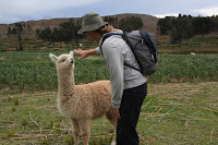
Jane and I had better luck with a baby alpaca.
On our way to Yampupata, we met a man who owned a boat and his dog who happened to be CRAZY about duck hunting. Brandon and Garrett helped him carry some untreated wood (looked a lot lighter than it was) to his dock. In return, the man gave us a cheap boat ride to Isla del Sol. All we had to do was paddle.
Just kidding he gave us a ride in this boat...with a motor.
When we arrived to Isla del Sol, where we were greeted by yet more stairs. There's nothing better than climbing steps above the world's highest navigable lake (3800 m). Sarcasm aside, we found a hostel with killer views of both the east and west at the summit of the island. While the view didn't last long, that night we watched an incredible electrical storm from our terrace...while drinking boxed wine.
The next day, we caught a boat ride to the north end of the island and hiked a bit more. We checked out a sacrificial rock and an Incan labyrinth. We both have to admit that after Machu Picchu, these ruins seemed to be a bit disappointing. But all in all it was a nice walk.
Wednesday, January 09, 2008
Another One Bites the Dust
Well...we've lost another good camera out here on the road. Here's what happened...
To catch you up, I broke my camera in the Galapagos so Brandon sprung for a new camera when we were in Lima. Hence, the camera was only about 2 weeks old.
We were on a bus heading from Cusco, Peru to Puno, Peru which is on Lake Titicaca and the Bolivian border. The ride takes about 7 hours and winds through the Andes mountains. Because the road was quite curvy, baggage tended to shift a bit.
Brandon had put his small backpack between his feet, but we both fell asleep pretty soundly. With the excessive twisting and turning his backpack moved around a bit, but it was still in contact with our feet.
Turns out we must have been much more comatose than we thought. We made a stop in a town about 45 minutes outside of our destination when Brandon had a weird feeling about the position of the bag. He started fishing through the backpack only to find that the new camera and both battery chargers and batteries had been lifted (we still had the chargers and batteries from my broken camera).
I quickly ran to the front of the bus to inform the bus driver and attendant that we had been robbed, but, in so many words, they told me that I was shit out of luck. Whoever, had taken the camera was long gone.
Luckily, the perpetrator had only gotten a hold of our camera equipment, but, no matter how many times we've been robbed, the initial realization that something is missing SUCKS.
To add insult to injury, the next day on our way from Puno, Peru to Copacabana, Bolivia which sits on the other side of Lake Titicaca we noticed that our traveler's checks had been lifted off of us. We figure it happened in our hostel in Cusco because if the thief on the bus from the previous day had gotten into my backpack, my wallet would have been long gone.
Anyhoo, we're thinking that the cleaning boy from the hostel in Cusco liberated us of our traveler's checks because he would "do us the favor" of organizing our belongings everyday. While we were pissed that the guy stole from us, we weren't too worried about it because it's usually pretty difficult to cash traveler's checks in foreign countries...you usually need a passport as well as a matching signatures. Well, turns out that's not the case in Peru...
When we called from La Paz, Bolivia to report the checks stolen we found out that Brandon's checks had been cashed...he has to wait four weeks while an investigation regarding his stolen checks ensues. Fortunately, I was able to pick up new traveler's checks in La Paz and the lady at the office informed us that it's actually really easy to get traveler's checks cashed in Peru...so easy that most Bolivian thieves cross the border to cash their stolen traveler's checks. Convenient, huh?
To top it all off, we arrived in Copacabana, Bolivia with minimal cash because we were planning on taking money out of an ATM or from a bank. We decided this would be the best course of action because there is a huge problem with counterfeit bills in Peru. Another interesting point...the money changers on the borders tend to have plenty of these fake bills.
Well, this ended up biting us in the butts because we arrived on Saturday assuming (yes, it does make an ASS out of U and ME) that the banks would open on Monday morning. While we had enough to get through the weekend, we REALLY needed to get to the bank bright and early Monday morning.
Turns out...the bank in Copacabana is closed on Mondays and Tuesdays. Makes perfect sense! We toured the small town to see if the two hotels that actually accept credit cards could give us a cash advance. No luck...we could've really used our stolen traveler's checks right about now.
Thank goodness we were with our very prepared South African friend who was able to spot us some cash until we could get to an, OPEN, bank.
Sunday, January 06, 2008
We Made it to Boilvia...$200 poorer
Friday, January 04, 2008
The Inca Trail & Machu Picchu
Alright, alright, I know you've heard this before, but the Inca Trail was DEFINITELY the most challenging trek to date. We decided to do the 4 day/3 night trek over the New Year. What better way to bring in the New Year than to be out in the middle of nowhere?
The Inca Trail is part of the 23,000 km of roads built by the Incas throughout South America. This 45 kilometer trek winds through a variety of altitudes, ecosystems, and climates. One day you're in a cloud forest, the next you're in the high Andes (4200 meters), and finally you wind down into the edge of the jungle to the huge Inca city of Machu Picchu. Throughout the four day hike you encounter other Inca ruins as well.
We started the trek on the 30th of December. We figured we should be pretty prepared for the trek given the amount of hiking we had been doing throughout Peru. Our guide from Colca Canyon made it sound like the Inka Trail was difficult, but not as hard as the canyon. The only factor that would be new to us on the Inka Trail was carrying four days worth of clothes, water, a mattress, and sleeping bag.
As of 2001, hikers are no longer able to walk the trail independently...everyone has to go with a guide through an agency. While we didn't book the high-end option where the porters carry absolutely everything for you, our company's porters did carry the food, kitchen, and tents. Even without having to carry these items we were both still hauling about 10 kilograms (22 pounds)...water is heavy.
It's the rainy season in the mountains of Peru right now, so we had our fingers crossed for good weather. The night before we left it poured down rain, but the morning was absolutely gorgeous. We were REALLY hoping that our luck would hold out.
The first day went smoothly. There was only a light dusting of rain when we stopped to eat lunch and the inclines were pretty mellow. It took a little bit of time to get used to carrying the extra weight on our backs, but by the end of the day we were pretty used to it.
The second day of the trail was supposed to be the most challenging because you climb up to 4200 meters to cross the Warmiwañusqa pass. One very common problem for people on this day is altitude sickness. We were well aware of the affects of altitude from our trek in Huaraz so we had arrived in Cuzco 3 days before our trek began. As it turns out, not everybody had been so careful. The other common problen for hikers on the second day is lack of conditioning. The combination of the two looked pretty painful.
The climb on the second day is divided up by two camps. It takes about an hour and a half to get to the first, another hour and a half to get to the second, and then there's a final hour and half to the top. From our previous hikes, we had learned that it's best to keep a slow, steady pace when hiking at high altitude. Apparantely, not everyone was savvy to this concept either. While we were walking up the first section of the climb people we already blowing chunks off the side of the mountain.
At points, the climb was pretty painful because rather than just a steady incline of switchbacks, the Inca laid stone stairs most of the way up the mountain. These weren't your regulation size steps either. Some of the sections used huge rocks. Climbing up these with an extra twenty pounds on our backs didn't tickle.
Well, we started into to the last hour and a half section when the skies decided to open up on us. At first, it was a light rain, but it quickly escalated to a solid downpour and when we started to approach the pass we were being pelted by hail. By the time we got to the top of the pass, even with all of our waterproof gear, we were totally soaked and freezing. Our hands were so cold that the finger nails hurt. We both quickly got familiar with the motivational idea of "one step closer".
We continued another hour walking to get down to camp for the night...New Year's Eve. Thanks to our backpack rain covers, the rain hadn't totally soak through our backpacks and gotten all of our clothes wet...most people on the trail couldn't say the same thing. After warming up in our tent we had dinner and brought in the New Year at about 8pm with the finest box of red wine you can buy.
New Year's day was absolutely gorgeous. In the morning the sun was out and we were able to dry out most of our gear. We could see the glaciers on the other side of the mountain range framed by fluffy white clouds. We continued on the trail up to one more peak and then started the drop down into the cloud forest and the jungle. The views were absolutely STUNNING! You've gotta check out our pictures.
We made it to camp most of the way dry on the third and final night. Our legs and knees were pretty shot because we, basically, walked down slippery, lopsided stairs the entire day. We got to bed pretty early because we had to wake up at 4am the next day to make the final push for Machu Picchu.
At about 1am we both woke-up to pounding rain on our tent. About another hour later I woke up soaking wet...it was raining so hard that the water was penetrating our tent. We still had our fingers crossed that the rain would let up before we had to get on the road at 4am.
Lady luck shone down on us and the rain stopped just as we were getting out of our tent. We ate a quick pancake and then started the hour hike to the Sun Gate that looks down onto Machu Picchu. We were able to ditch our sleeping bag and mattress because the porters had to take them back to the company and with the lighter backpacks we HAULED!
We were in the first small group of people to make it to the Sun Gate and thank goodness for that. We were actually able to see Machu Picchu...we were both totally stoked! A lot of people walk for 4 days to see this view and all they get is fog. It was such a great feeling to come over the top of the mountain and see Machu Picchu with its surrounding mountains laid out before us. We enjoyed the AWESOME view for about a half hour before the fog rolled back in. Unfortunately, the people who were too far behind us didn't get to see the city from the Sun Gate.
The ruins of Machu Picchu were impressive, but Brandon and I both agree that its surrounding scenery is was made this place truly amazing. It's crazy that these people were able to construct this huge citadel out of granite on the side of sheer, steep mountains. The pictures we took are beautiful, but they don't do this place justice.
After wandering around the wet ruins for a few hours we caught the bus into the nearby town of Aguas Calientes and went for a much needed dip in the thermal baths. From there we were on a train back to Cuzco. By the time we made it back to our hostel, we were both completely exhausted.
While thousands of travelers walk the Inca Trail every year, it was still a unique and stunning hike. We both definitely felt accomplished when we took the final steps into Machu Picchu.
Thursday, January 03, 2008
Check Us Out...We're on T.V.
Looks like Huntington Beach City Lifeguards are the newest reality T.V. stars. If you're interested, the name of the show is "Ocean Force" and you can find it on Tru T.V. (formerly Court T.V.). I guess the first episode aired on New Year's Day and you can watch the rest on Mondays at 8pm. We've posted a link to the website. Please don't laugh at us too hard...
Tuesday, January 01, 2008
Subscribe to:
Posts (Atom)